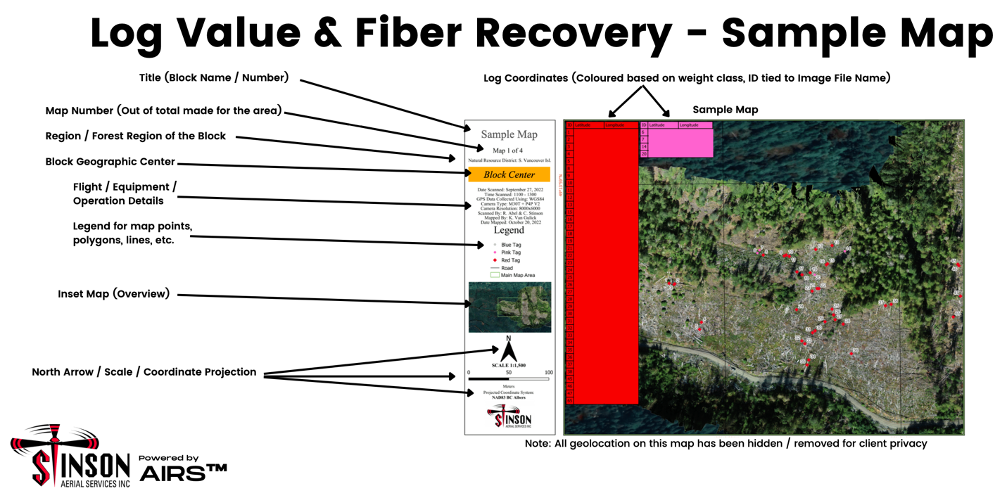
Stinson Aerial advancing their Aerial Image Recognition System (AIRS) beyond wildfire to improve efficiencies and safety for helicopter log salvage operations.
With a slow start to the 2022 Wildfire season, we set off to design some new ideas for the IFR aircraft in our fleet as well as assess our place in the drop industry overall. As part of our fleet, we operate the M30T and The M2EA aircraft which are both enterprise InfraRed editions from DJI. We set off with our drones, trucks and maps and headed out to an active helicopter logging block to see how we could apply our Aerial Image Recognition System (AIRS) that we have designed for wildfires operations and design AIRS into our Forestry Operations. Our vision with drones revolves around creating Actionable Data for our Clients and it didn’t take the flight crew long to figure out a couple of workflows to test. Our champion, Ray Bartram, Ryka Industries was instrumental in guiding our improvements and helping us zone in on the deliverables for his operation. Ray has found his niche with our system and has now submitted applications for approval using stand alone drone data and also improved the operational efficiency using our geo referenced maps from Pre-Marking to Bucking to Post Harvest evaluation for the next pass!